Citymapper
- 4.8
- Rating
- 10.00M
- Installs
- Free
- Price

 Analysis by App-foxy
City travel usually goes wrong in small, annoying ways: the train platform changes, a bus arrives earlier than expected, a connection looks possible but leaves no margin, or a familiar route becomes useless because of a delay. I found that Citymapper’s strongest capability is its ability to turn public transport into a step-by-step journey rather than leaving me to interpret a map on my own. That difference matters most when I am moving through a city I do not know well.
Developed by Citymapper Limited, this free Maps & Navigation app is aimed at people who combine buses, trains, subways, walking and other city transport options. It has been available since April 11, 2013, and its 4.8 average from around 362 thousand ratings helps explain why it has become a familiar choice for urban travel. It is rated for Everyone, has passed 10 million installs, and includes optional in-app purchases ranging from $1.49 to $99.99 per item.
Why Citymapper’s route guidance feels different
The useful idea here is not simply showing where I am. A basic map can already do that. Citymapper focuses on the complete trip: where to walk first, which public transport service to take, where to change, and how to finish the journey. That makes it especially valuable when the route involves several decisions rather than one direct ride.
You May Also Like

 Blood Strike: 2.5 Anniversary
Blood Strike’s Loadouts Turn Every Drop Into a Tactical Gamble
A close look at Blood Strike’s custom loadouts: how fast access to signature weapons reshapes its battle royale rhythm, rewards preparation, and narrows the gap between fights.

 Pandora - Music & Podcasts
Pandora’s Music Is Easy to Start, but Harder to Recover
Pandora’s strength is its low-effort path from a seed to a station. Its weak spot is how much confidence it asks you to place in connection, setup, and quiet recovery.

 8 Ball Pool
 Is Built on Rivalries, Rematches, and Routine
A close look at the rivalries, rematches, shared routines, and unanswered safety questions that turn a quick pool match into a persistent mobile community.

 Samsung Music
’s Quiet Strength Is Playing What You Already Own
Its reach comes less from spectacle than from dependable access to a personal library. That simplicity is both the app’s strongest retention engine and its ceiling.

 AccuWeather: Weather Radar
AccuWeather Review: A Quick, Clear Forecast for Everyday Decisions
For everyday plans, the best forecast is the one you can understand quickly. AccuWeather makes rain timing, radar, and local conditions easy to act on, with a few trade-offs.

 Hill Climb Racing
Why Hill Climb Racing Still Turns Crashes Into One More Run
A tiny car, a bumpy hill and one more upgrade: Hill Climb Racing keeps resurfacing because its simple chaos makes every near-miss feel personal.
More From Our News Desk
View All News


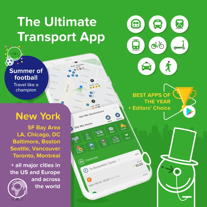
When I enter a destination, I am not forced to build the journey manually from separate transit maps. The app presents route choices that combine the transport network with walking. In practical terms, this means I can compare a route that uses a subway with one that relies on a bus, or choose a slightly slower option with fewer changes when I am carrying luggage or traveling with someone who does not want to rush.
The app’s store summary specifically points to city navigation involving MTA, MBTA, NJ Transit, bus times and subway maps. That makes its focus clear: this is designed around public transport in urban areas, not around long-distance driving or rural navigation. Its value depends on how well the city’s available transport information supports the journey, so I see it as a city movement tool rather than a universal replacement for every map app.
The main benefit is reduced mental effort. Instead of constantly asking myself whether I am still on the correct line or which exit leads toward the destination, I can use the route as a sequence of manageable actions. The best results appear when I check the whole journey before leaving, then use the individual steps while moving.
Reading a route without overthinking it
I recommend looking beyond the first suggested route. The fastest option is not automatically the best one. A route with an extra transfer can become unpleasant if the interchange is large, crowded or unfamiliar. Another route may take longer but offer a simpler ride and a more comfortable walk at the end.
Citymapper is most helpful when I treat those alternatives as practical choices rather than as a ranking I must obey. If I am late for an appointment, I may accept more walking to save time. If I have shopping bags, I prefer fewer changes. If the weather is poor, the shortest outdoor section can matter more than a small difference in arrival time.
This is one of the app’s less obvious strengths: it makes the trade-off visible enough for me to choose according to the situation. A conventional paper map can show the network, but it does not easily translate that network into the decision I need to make at a particular moment.
What using it feels like during a real trip
Imagine arriving in a city for the first time with a hotel address and a dinner reservation. I would enter the restaurant, check the suggested public transport routes, and compare the number of changes with the expected travel time. Before boarding, I would confirm the first walking section and the station or stop I need. During the ride, I would keep the next transfer in mind instead of trying to memorize the entire network.
At the interchange, the important detail is not just the line name. I need to know whether I should leave the vehicle, find another platform, or continue on the same service. This is where a journey-focused planner is more useful than a standard street map. It gives the trip a beginning, middle and end, which is reassuring when signs are crowded or local transport terminology is unfamiliar.
For the final stretch, I would check the walking direction before leaving the station or stop. That small habit prevents a common mistake: exiting on the wrong side of a large station and then spending several minutes walking around the block. The app does not remove every uncertainty, but it gives me a clearer sequence to follow.
When the live journey matters most
Public transport plans are fragile. A route that looks perfect at home may be less useful after a delay or a missed connection. Citymapper’s purpose is strongest at that point because I can reconsider the journey instead of clinging to the original plan. If a transfer no longer makes sense, I can compare the alternatives again and choose a different combination of walking and transit.
I would still keep an eye on station signs and announcements. No route planner should be treated as the only authority during service changes, emergency closures or confusing platform situations. The practical workflow is to use the app for planning and orientation, then verify important changes locally. That combination is safer than blindly following any navigation tool.
A useful habit is to plan a little before stepping onto the first vehicle. I like knowing the transfer point and the final stop in advance, even if I do not memorize every instruction. It reduces the temptation to stare at the phone for the entire ride and makes it easier to notice when the physical environment does not match the route.
Where the app earns its place
I find Citymapper most useful when a journey depends on several small decisions, and this section looks at how a connected phone can make those decisions easier—or more fragile. I’ll focus on the moments when route details matter, then turn to the different ways people use the app while moving around a city.
The best scenario: unfamiliar city, multiple connections
The clearest use case is a visitor navigating a large city for the first time. A direct subway ride is easy enough to understand with a regular map, but a journey involving a bus, a rail service, walking and a transfer can become tiring quickly. Citymapper brings those pieces into one itinerary, which is exactly the situation where I would recommend it to a friend.
It is also useful for residents who know their usual commute but occasionally need a different route. A delayed line, a meeting in another neighborhood or an evening trip can expose gaps in local knowledge. Rather than opening separate operator maps and comparing them manually, I can start with one combined route and then adjust it based on comfort, time or the number of changes.
Another good scenario is traveling with a visitor. I can use the route planner to explain the journey in simple stages: walk to this stop, take this service, change here, then walk to the destination. That is easier than pointing at a dense transport diagram and expecting someone else to understand it immediately.
Useful habits that are easy to miss
First, I would compare routes by complexity, not only arrival time. Counting changes and checking the walking portions gives a better picture of the real effort. A route that saves a few minutes may demand a hurried transfer, while a simpler option can be more reliable for a relaxed day out.
Second, I would use the app before entering a station, not only after a problem appears. Checking the route at street level helps me identify the correct entrance and understand the direction of travel. This is particularly useful in areas where a station has several entrances spread across a busy intersection.
Third, I would treat the final walking section as part of the route rather than an afterthought. The last few minutes often determine whether I arrive at the correct building, gate or side of a complex. Looking at that section early can reveal that the destination is farther from the transport stop than its name suggests.
Fourth, I would save a mental fallback. If the first route becomes impractical, I want to know whether another line or a longer walk could still get me there. Citymapper is more useful when it supports this kind of decision-making than when I use it as a single fixed instruction.
Where it can be frustrating
The app is not equally valuable for every journey. If I am driving, planning a road trip or navigating an area with limited public transport, a driving-focused map may be a better fit. Citymapper’s identity is urban transit, so using it outside that setting misses the reason to install it.
Even in cities it supports well, route information can be affected by the quality and timeliness of local transport updates. A planner can suggest a sensible connection, but real life includes crowding, platform confusion, short transfer windows and vehicles that do not behave exactly as expected. I see the app as an informed guide, not a guarantee of a perfectly timed journey.
There is also a learning curve for people who rarely use public transport. The number of route alternatives can feel like too much choice, especially when every option includes different lines, stops and walking segments. New users may need a few trips before they become comfortable comparing routes instead of simply selecting the first one.
Phone dependence is another practical drawback. A navigation app is less helpful when the battery is low, the signal is unreliable or I am distracted by a crowded street. I prefer to check the route in advance and remember the key transfer, rather than assuming I can keep consulting the screen at every corner.
The free price makes trying it easy, but the presence of optional purchases means that some users may encounter paid elements depending on how they use the app. I would install it first for the core journey-planning experience and decide later whether any optional extras are worthwhile. The app should not be judged as a replacement for every transport operator’s own service information.
How it compares with familiar alternatives
Google Maps is often the default choice because it combines streets, businesses, walking directions and many types of transport in one broad platform. I would choose it when I need to find a shop, inspect an area or combine public transport with other map information. Citymapper feels more focused when the actual problem is moving through a transit network with several stages.
Official transport apps can be better for a single operator’s alerts, ticketing or detailed service notices. If I already know which network I need and want the operator’s own information, that specialized app may be the more direct option. Citymapper is more convenient when the journey crosses different services and I do not want to assemble the plan myself.
Paper maps still have one advantage: they provide a broad view without depending on a battery or a live connection. I would not use one alone for a complicated first visit, but it can help me understand the shape of a city. Citymapper wins for immediate decisions; a physical map wins for orientation and backup.
Who should install it?
I think Citymapper is a strong choice for commuters, city visitors, students, and anyone who regularly combines walking with buses, subways or trains. It is especially suitable for people who find transit maps intimidating or who want to compare a quick route with a less complicated one. The Everyone age rating also makes it approachable for a broad audience, although younger users should still follow normal travel-safety habits.
It is less convincing for someone who mainly drives, lives where public transport is sparse, or wants a full road-navigation tool. It may also frustrate users who expect every route to be perfectly current during unusual disruptions. In those cases, a car-navigation app or an official transport source can be a better companion.
For my own use, the deciding question is simple: do I need help understanding a multi-step public transport journey? If the answer is yes, the app earns space on my phone. Its 10-million-plus installs and strong average rating suggest that many other travelers have found the same practical value, but the experience still depends on the city and the kind of trip.
My recommendation is to use it as a calm planning layer, not as an unquestionable authority. Check the route before leaving, compare the alternatives, pay attention to transfers, and confirm important changes with local signs or announcements. Used that way, Citymapper does more than draw a line between two places: it helps turn an intimidating urban journey into a set of decisions I can actually manage.
FAQs for Citymapper
01What is Citymapper and how does it work?
Citymapper is a comprehensive transportation app designed to help users navigate urban areas efficiently. It provides real-time data on public transit, walking, cycling, and ride-sharing options. Users can input their destinations to receive step-by-step directions, estimated travel times, and costs, making it a versatile tool for city travel.
02Is Citymapper free to use, and are there any in-app purchases?
Citymapper offers a free version with essential features for navigating cities. However, there are optional in-app purchases available, such as Citymapper Pass, which provides additional perks like unlimited travel on certain transit networks. These purchases are designed to enhance the user experience, but the core functionality remains accessible at no cost.
03Which cities are supported by Citymapper?
Citymapper covers a wide range of major cities globally, including New York, London, Paris, Tokyo, and more. The app continuously expands its coverage, adding new cities based on user demand and data availability. It’s advisable to check Citymapper’s website or app for the latest list of supported cities before traveling.
04How accurate is Citymapper's real-time data and navigation?
Citymapper is known for its accuracy in providing real-time transit data, thanks to its integration with local transit authorities and its use of advanced algorithms. While no app can guarantee 100% accuracy due to unforeseen delays or changes, Citymapper is highly reliable and often updated to reflect the latest transit conditions.
05Can Citymapper be used offline, and how effective is it without an internet connection?
Citymapper offers offline capabilities by allowing users to download maps and routes in advance. This feature is particularly useful in areas with limited connectivity. While real-time updates won't be available offline, pre-downloaded information can still guide users effectively through their planned routes, maintaining a level of convenience.
Pros
- Intuitive interface makes navigation easy.
- Real-time data ensures accurate trip planning.
- Multi-modal options include biking and walking.
- Offline maps available for data-saving convenience.
- Regular updates keep information current.
Cons
- Limited coverage in smaller cities.
- Can drain battery quickly during use.
- Requires internet for real-time updates.
- Occasional inaccuracies in transit timings.
- Ads in free version can be intrusive.

Citymapper
Gallery